
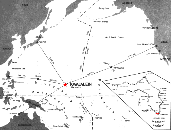
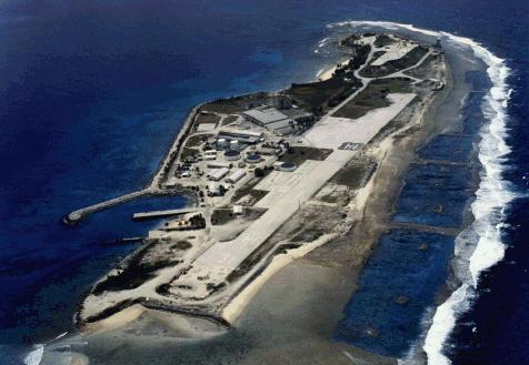
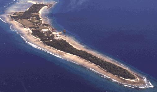
Kwajalein Atoll is one of the 34 West Central Pacific Ocean atolls that make up the Republic of the Marshall Islands. Kwajalein Atoll is a coral reef formation in the shape of a crescent loop, enclosing the world's largest lagoon with a surface area of 1,100 square miles. Situated on the reef enclosing the lagoon are approximately 100 small islands with a total land area of 5.6 square miles. Kwajalein Island, one of the three largest islands in the atoll, is 1/2 mile wide and 3 miles long (approximately 1.5 square miles in area.) Kwajalein Atoll lies 2100 nautical miles southwest of Honolulu, Hawaii. Click here to see a map.
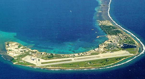
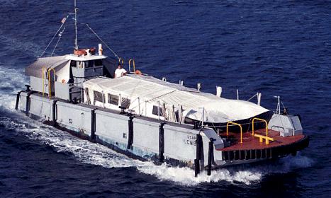
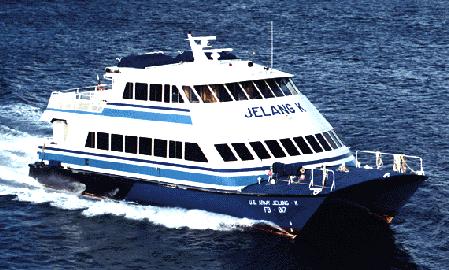
Kwajalein Island is the focal point of the United States Army Kwajalein Atoll/Kwajalein Missile Range (USAKA/KMR), an Inter-continental Ballistic Missile testing facility under the auspices of the United States Army Space and Missile Defense Command (USASMDC). The island is actually a U.S. Army Base, but there are only about 100 DoD personnel on-island. The rest are contractors and dependants. The largest contractor on-island is Raytheon Range Systems Engineering (RSE), which currently has about 2000 people on-island. The rest of the daily population is made up of the 1000 or so Marshallese natives that commute to work everyday in a boat called an LCM.
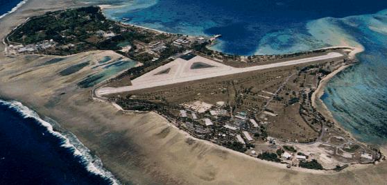
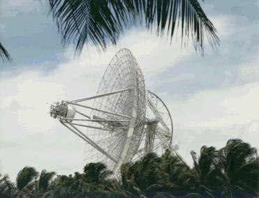
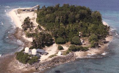
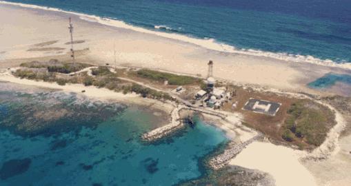
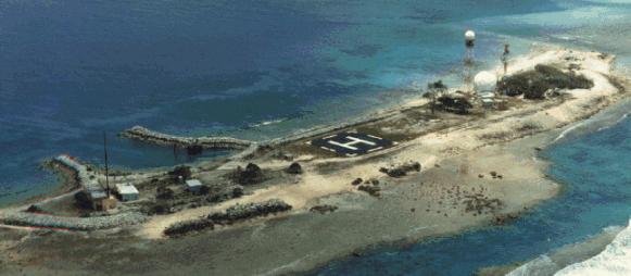
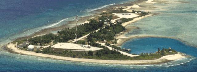
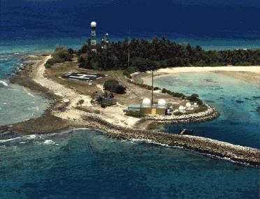
Kwajalein is not the only island in the atoll that people work on, though. Other islands in USAKA/KMR include Roi-Namur, home of Altair the worlds largest radar antenna, Meck, where they do missile launches, and some smaller optics and telemetry sites such as Carlos, Eniwetak, Gagan, Gellinam, Illeginni, and Legan. Roi-Namur is the only other island in USAKA/KMR that has housing, so people who work at the smaller islands have to commute by catamaran or helicopter.
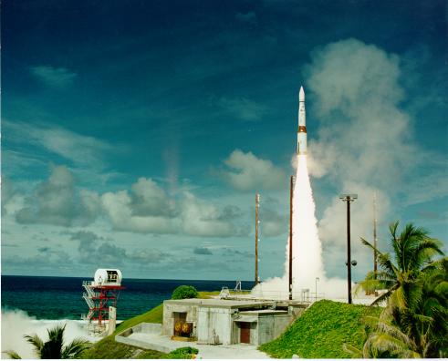
So what goes on in Kwajalein, you ask? The main reason the Army occupies this little island in the middle of
the ocean is for the purposes of tracking, measuring, testing, and evaluating Inter-Continental Ballistic Missiles
and the radars that are designed to spot them. A typical mission consists of a missile being fired from
Vandenburg Air Force Base in California (among other sites) and about 15 different radars, optics, and telemtry
sites tracking the vehicle and its associated warheads to splash-down in Kwajalein Lagoon. Missions can be a
remarkable light show in the night sky over the lagoon, or they can be boring old radar tracks that you wouldn't
even know were going on unless you were working the command console. Every now and then we get some international
attention for a mission or set of missions that the Range conducts. We even made the cover of
Life Magazine in 1967! Check out these two optics pitures of actual missions conducted
on Kwaj!
|
| |||||||

Want to see where your tax dollars live? Go to
the USAKA/KMR home page. | Lots of technical stuff, not much human interest, some cool pictures 
Here's the Republic of the Marshall Islands home page,
RMI Online | Not bad considering the fact that 90% of the population has probably never actually seen a computer. 
Then of course there's the web page for people that were on Kwaj during the nuclear
testing period: The Kwaj Connection | This is what happens to people who spend too much time "on-island". Standing in front of the radars, were we?
Want more information on life at Kwajalein? Check out the
Kwajalein Jr/Sr High School Home Page | This is an excellent page put together by the students at the school. Includes some great pictures. | |||